Surveying Property - DIY Risk Checks
Flood risk, radon, subsidence and local crime ratesWhen buying a property it’s essential to do your homework
Before arranging your survey there’s a lot you can find out yourself online. For example you can check any obvious risks from flooding, radon and ground contamination, along with local crime rates. It’s also worth visiting the local authority’s website to search planning applications for the property you’re buying.
Surprisingly, standard conveyancing searches don’t check whether your new neighbours have made any planning applications – so be sure to check this too! Armed with this information you could ask your conveyancer and surveyor for their professional advice.
Tree roots and buildings
Click here for useful advice from RICS – including safe distances to plant trees from buildings to prevent subsidence
Check flood risk
Just type in your post code to find out if your property is at risk – from sea/river flooding or from surface water & reservoirs
Check local crime rates
Compare crime rates and outcomes in your postcode area
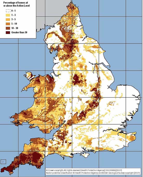
Check for radon
Click the map to find out more about Radon risk, including Electromagnetic fields (EMFs)
Ground contamination
If the site a property was built on was ‘brownfield land’ – i.e. former industrial / non residential use – your conveyancing solicitor should be able to confirm this from local authority land searches. In areas where there was any significant risk the developers would normally have been required to make the site safe as a condition of their planning consent, and the methods used approved by Building Control.
The problem with paying for a special ‘Enviro Report’ is they tend to be very long-winded yet rather vague, hence they can worry you unnecessarily. Testing for contamination involves digging boreholes which can be very expensive. So the Local Authority is normally your best bet in the first instance.
Social Housing
This is a site surveyors use to check whether a proeprty is classed as being in public sector ownership. It’s a searchable database of all registered UK social housing.
Type in the name of the road into the search bar at the top and if it shows the road then if it’s a social housing road.
Old maps – what was there before?
Here are some useful tools for dating properties or checking the former use of the land they’re built on.
These 2 old map websites provide data up until about the 1980s: Old-maps.co.uk and Oldmapsonline.org

To use it you first need to download the programme at: https://www.google.co.uk/earth/download/gep/agree.html
Once installed, to use the historic maps search for first line of address or postcode. Enter this into the search bar at the top left side of the screen.
Then press VIEW and tick the Historical Imagery box – and click on it.
A timeline will appear in the top left of the map which you can move to travel through time (not literally!). You can also zoom in and out.


